Property Record
4450 Peachtree Lakes Dr, Berkeley Lake, GA 30096


NEARBY LISTINGS FOR SALE OR LEASE
Property Detail
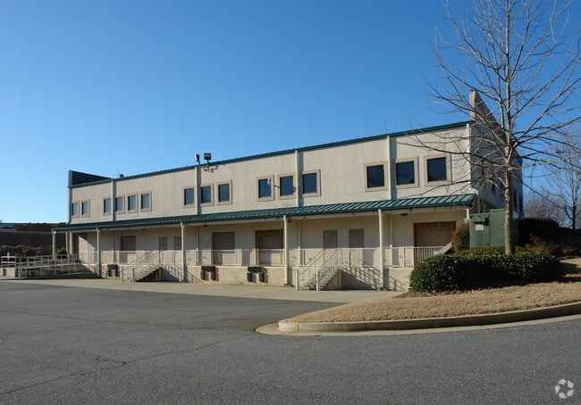
4450 Peachtree Lakes Dr
Atlanta-Sandy Springs-Roswell, GA
Peachtree Lakes Bus Ctr
6-268-048
L5 BA PEACHTREE LAKES BUS CTR
Religious
Gwinnett
X
Georgia
13121C0181G
5
0
2.54 AC
2025
Norcross
050323
Atlanta
16,224 SF
DEMOGRAPHICS near 4450 Peachtree Lakes Dr
1 mile
3 mile
5 mile
2024 Total Population
4,137
83,598
216,345
2029 Population
4,354
87,043
224,357
Pop Growth 2024-2029
+ 5.25%
+ 4.12%
+ 3.70%
Average Age
40
38
37
2024 Total Households
1,441
31,016
79,295
HH Growth 2024-2029
+ 4.72%
+ 4.10%
+ 3.78%
Median Household Inc
$133,314
$69,312
$66,813
Avg Household Size
2.80
2.70
2.70
2024 Avg HH Vehicles
2.00
2.00
2.00
Median Home Value
$445,203
$353,230
$378,166
Median Year Built
1992
1991
1991
Nearby Places
Map Layers
Map Styles
 Street
 Aerial
Transit
 Traffic
 Biking
Places
Listings with unknown addresses are not visible on the map
- Restaurants
- Banks
- Shops
- Fitness
- Groceries
PUBLIC TRANSPORTATION
AIRPORT
Hartsfield - Jackson Atlanta International
Drive
Walk
Distance
Hartsfield - Jackson Atlanta International
48 min
32.8 mi
Nearby Properties
Address
Land Use
TOTAL SIZE
Lot Size
Zoning
Address
Land Use
TOTAL SIZE
Lot Size
Zoning
794,057 SF
78.64 AC
PUD
Address
Land Use
TOTAL SIZE
Lot Size
Zoning
599,105 SF
9.13 AC
M1
Address
Land Use
TOTAL SIZE
Lot Size
Zoning
508,494 SF
38.74 AC
RM13
Address
Land Use
TOTAL SIZE
Lot Size
Zoning
761,929 SF
65.19 AC
RM13
Address
Land Use
TOTAL SIZE
Lot Size
Zoning
356,984 SF
24.89 AC
PUD
Address
Land Use
TOTAL SIZE
Lot Size
Zoning
346,219 SF
21.95 AC
PUD
Address
Land Use
TOTAL SIZE
Lot Size
Zoning
425,597 SF
49.61 AC
RM13
Address
Land Use
TOTAL SIZE
Lot Size
Zoning
523,344 SF
40.47 AC
RM
Address
Land Use
TOTAL SIZE
Lot Size
Zoning
439,676 SF
42.88 AC
RM13
Address
Land Use
TOTAL SIZE
Lot Size
Zoning
450,815 SF
45.79 AC
RM10
Address
Land Use
TOTAL SIZE
Lot Size
Zoning
423,004 SF
47.93 AC
RM
Address
Land Use
TOTAL SIZE
Lot Size
Zoning
503,097 SF
40 AC
RM13
Address
Land Use
TOTAL SIZE
Lot Size
Zoning
491,482 SF
41.72 AC
C1
Address
Land Use
TOTAL SIZE
Lot Size
Zoning
620,975 SF
8.10 AC
PUD
Address
Land Use
TOTAL SIZE
Lot Size
Zoning
286,481 SF
20.06 AC
M1
Address
Land Use
TOTAL SIZE
Lot Size
Zoning
231,192 SF
12.88 AC
RM13
Address
Land Use
TOTAL SIZE
Lot Size
Zoning
341,506 SF
36.69 AC
C1
Address
Land Use
TOTAL SIZE
Lot Size
Zoning
426,839 SF
37.47 AC
MUD
Address
Land Use
TOTAL SIZE
Lot Size
Zoning
250,886 SF
22.93 AC
RM13
Address
Land Use
TOTAL SIZE
Lot Size
Zoning
329,029 SF
21.16 AC
C1
Address
Land Use
TOTAL SIZE
Lot Size
Zoning
483,279 SF
8.27 AC
BH
Address
Land Use
TOTAL SIZE
Lot Size
Zoning
609,495 SF
6.28 AC
PUD
Address
Land Use
TOTAL SIZE
Lot Size
Zoning
220,150 SF
21.08 AC
RM13
Address
Land Use
TOTAL SIZE
Lot Size
Zoning
561,975 SF
41.78 AC
RM13
Address
Land Use
TOTAL SIZE
Lot Size
Zoning
418,495 SF
22.06 AC
PUD
Address
Land Use
TOTAL SIZE
Lot Size
Zoning
220,915 SF
2.38 AC
HX
Address
Land Use
TOTAL SIZE
Lot Size
Zoning
88.90 AC
AG1
Address
Land Use
TOTAL SIZE
Lot Size
Zoning
351,072 SF
20.03 AC
RM24
Address
Land Use
TOTAL SIZE
Lot Size
Zoning
225,314 SF
68.32 AC
OI
Address
Land Use
TOTAL SIZE
Lot Size
Zoning
287,824 SF
31.59 AC
RM
The World's #1 Commercial Real Estate Marketplace
Connect with us
© 2026 CoStar Group
The information above has been obtained from sources believed reliable. While we do not doubt its accuracy we have not verified it and make no guarantee, warranty or representation about it. It is your responsibility to independently confirm its accuracy and completeness. Any projections, opinions, assumptions, or estimates used are for example only and do not represent the current or future performance of the property. The value of this transaction to you depends on tax and other factors which should be evaluated by your tax, financial, and legal advisors. You and your advisors should conduct a careful, independent investigation of the property to determine to your satisfaction the suitability of the property for your needs.